The Dolomites - The Perfect 3 & 4 Day Itinerary 🏔
Plus the opportunity to travel and hike together!
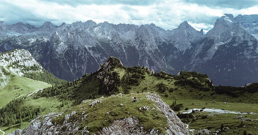
Have you, like me, ever wondered if The Dolomites was worth the trip or as beautiful as it is in all the glorious Instagram posts?
Well, I can safely say that after spending the last few weeks there hiking and living in a campervan, The Dolomites is somewhere that needs to be added to the bucket list! It didn’t just meet (in this circumstance my rather high) expectations but exceeded them and I’m already booking flights to go back!
So, that being said, I’m going to stop fangirling over this stunning Italian mountain range and share with you the perfect 3 or 4 day hiking itinerary to make the most of your trip to The Dolomites.
Day 1 - Lago di Braies to Croda del Becco
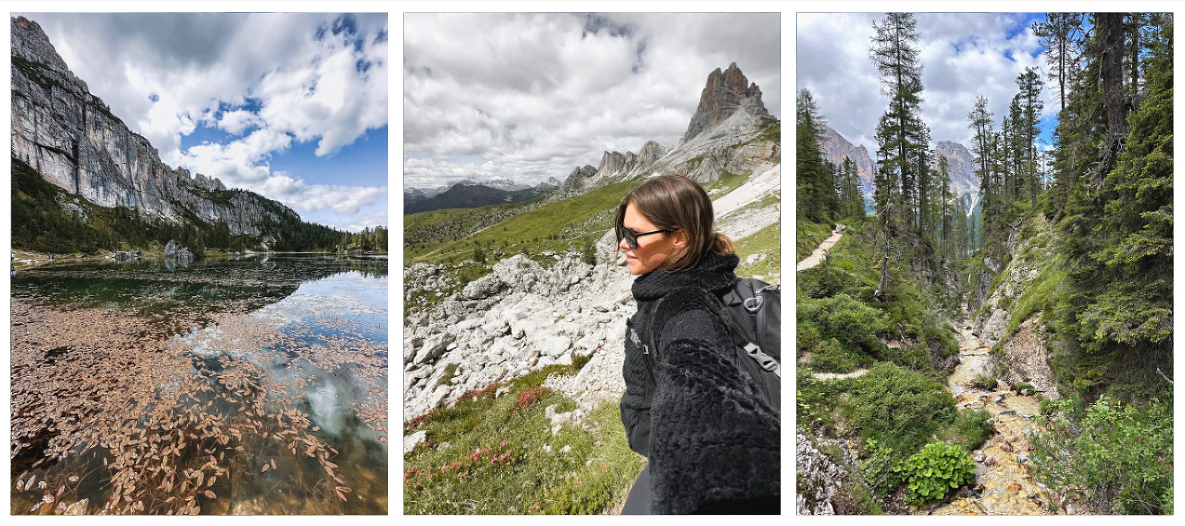
Lago di Braies is a picturesque glacial lake at the base of the north wall of Croda del Becco (Seekofel) which is known for it’s stunning turquoise water. While you can hike around the lake on well maintained paths, if you are looking for more of a challenge, set your sights on climbing to the top of Croda del Becco for the ultimate viewpoint!
Starting Point: Hotel Pragser Wildsee, Pragser Wildsee National Park
Distance: 15 km/9.3 miles
Elevation: 1,500m
Time: 6-7hrs
Difficulty: Intermediate - Well maintained and signposted paths with the last mile a steep ridge requiring some scrambling
Where to park: P3 or P4 Car Park, Pragser Wildsee National Park. €7/day for car or camper. We also stayed in the camper overnight in the P3 carpark and had to pay an additional €6 in the morning! Not a bad price for a night of stargazing over Seekofel and a morning walk around the lake before the tourists arrive!
Food, drink & toilets: There are food outlets and cafes around Hotel Pragser Wildsee as well as toilets and a picnic area. I would suggest bringing a packed lunch and eating it while enjoying the beautiful view from Croda del Becco before heading back down.
When to go: We began hiking around 2pm which meant we had the lake to ourselves in the evening and used the opportunity to skip stones in the lakes and enjoy the peace and quiet. It is a long hike though so make sure you allow plenty of time and daylight hours to get up and back down safely.
Top Tips: You can shorten this hike and simply complete the circular loop of Lago di Braies (approx 4km). You can swim in the lake but it’s pretty cold as it’s glacial water - maybe save that for the warmer days!
Day 2 - Tre Cime di Lavaredo & Cadini di Misurina
While most people would start this hike from Rifugio Auronzo, we started this from the toll booth at the entrance to Tre Cime di Lavaredo which turned out to take us through an amazing variety of landscapes and was of my favourite hikes of the trip. The hike takes you up to a circular loop at the base of the three iconic peaks of Tre Cime di Lavaredo. Make sure you continue on to the viewpoint of the glorious Cadini di Misurina, that view is not one to be missed and only a 10 minute walk from Tre Cime.
Starting Point: Casello Parcheggio 3 Cime di Lavaredo (toll booth)
Distance: 11km/7 miles
Elevation: 750m
Time: 4-5hrs
Difficulty: Intermediate
Where to park: As I mentioned, I parked at a small parking lot right next to the toll booth which was free and then followed the route up to Rifugio Auronzo. If you want to avoid the ascent you can pay the toll (€30 per car) and park at Rif. Auronzo.
Food, drink & toilets: Rif, Auronzo has food, drink and toilets. When you are finished for the day you can head towards Lago di Misurina where there are lots of restaurants, cafes and a small supermarket.
When to go: This hike is very, very popular so I would advise starting early. However, if you follow the route we did you can easily park at anytime of day (although you may still have to queue for the toll booth as the traffic backs up and you will be parking right next to it).
Top Tips: The road from Lago di Misurina towards Tre Cime di Lavaredo often has a sign saying the parking is full and the road is closed. We drove around this and had absolutely no problem finding a space so it might be worth investigating this (you can always turn around if required).
Day 3 - Cinque Torri - Rifugio Averau - Rifugio Croda da Lago
Cique Torri translates to the five towers and that is exactly what you get. Stomping around the base of this incredible rock formation you are immersed in both history and beauty. Not only are the views stunning and you could spend ages watching the climbers on the rocks but there are also shelters and trenches from WW1 that are now an open air museum.
Starting Point: Ponte de Ru Curto, Province of Belluno
Distance: 22.5km/14 miles
Elevation: 1400m
Time: 6-7hrs
Difficulty: Intermediate - well marked paths and a well trafficked route.
Where to park: Free parking along the road at Ponte de Ru Curto, Province of Belluno
Food, drink & toilets: Throughout this hike you will pass by lots of Rifugios which all serve food and drinks with ample seating as well as provide toilets. I took a packed lunch and enjoyed the view next to Cinque Torri but there are plenty of options along the route if you would like something local.
When to go: This hike is a slightly longer route although no doubt you’ll be stopping and starting like we were to absorb the stunning views along the way so give yourself plenty of time to enjoy the journey and make it back to your car. The parking tends to be pretty full by mid morning so this is something to bear in mind!
Top Tips: There are plenty of ways to shorten this route if required but if you are looking for a full day out in The Dolomites then add this circular route in and absorb everything the area has to offer. Afterwards head to Cortina d’Ampezzo for a bite to eat (we also stopped by a brilliant bakery here in the morning to get some fresh bread for our packed lunch)!
Day 4 - Rifugio Palafavera to Lago di Coldai
Lago di Coldai is a beautiful and popular lake that sits at the base of Civetta. This is a relatively simple out and back route that allows you plenty of time to enjoy the area surrounding the lake and the potential to increase the distance of the hike by adding on alternative routes too!
Starting Point: Rifugio Palafavera
Distance: 11km/7 miles
Elevation: 700m
Time: 4-5hrs
Difficulty: Moderate
Where to park: Rifugio Palafavera car park (free in certain areas)
Food, drink & toilets: The starting point has plenty of Rifugios to choose from for food, drink and toilets. We headed to the nearby town of Pecol where we found a small supermarket to get our packed lunch foods and stock up on water too.
When to go: This is a relatively short hike with plenty of parking and a well trafficked route so you could easily do this as a half day hike and head out at any time of day.
Top Tips: Make sure to spend a little bit of time exploring the area around the lake once you reach it as there are some really beautiful viewpoint into nearby townships and lakes as well as the stunning backdrop of Civetta.
Are The Dolomites worth it?
I can hands down say that the Dolomites were every little bit as beautiful as I was expecting and not only is there so much to explore but also something for everyone regardless of your experience or fitness level. Simply driving around the windy roads of the the Dolomites will provide you with the most inspiring and incredible views at every turn.
If you want to check out my specific routes for these hikes you can find them here. There will also be a Dolomites vlog coming shortly on my YouTube channel!
Want to travel together?
Finally, and most excitingly soon I will running overseas trips so we can hike, eat, and stay together while we explore incredible places like this! It has been my dream to be able to share these types of experiences with you so if it would mean the world to me if you could fill out this survey to let me know where you would like to go, what sort of activities you would enjoy and a few other details so I can get planning! If there’s one thing better than travelling alone its making memories and sharing experiences together!


